Analysis of the GRACE/GRACE-FO sensor data
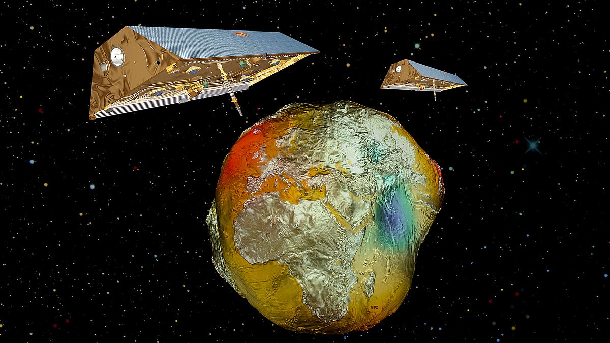
Changes in the Earth system are inferred from the GRACE and GRACE-FO satellite missions via precise measurements of relative differences in the orbits of the two satellites, which revolve around the Earth at a distance of about 220 km in a low orbit of initially 500 km height. One orbit takes only about 95 minutes and passes over both poles of the Earth, so that, as the Earth rotates underneath the space-fixed orbital plane, it is possible to gradually fly over all the places in the world at least once. GRACE and GRACE-FO thus differ fundamentally from other Earth observation missions by the fact that none of their measuring instruments are actually oriented in the direction towards the Earth's surface.
Five different sensors for gravity field determination
A core element of gravity field missions is the precise measurement of relative distances, velocities and accelerations between the twin satellites. On GRACE, this information was obtained via a microwave ranging system. Since 2018, GRACE-FO has also been using a laser interferometer, the most precise measurement technology currently available for distance measurements. This increases the precision of the distance measurement by almost two orders of magnitude. Since both satellites are travelling without continuous propulsion, they can be regarded as weightless test masses in space whose changes in position are caused solely by the external forces acting upon them. The spatially variable gravitational field around Earth can then be inferred from precisely surveyed orbits. The distance measurements are supplemented by (less precise) position determinations with GPS receivers, which are mounted on the top of the satellites and process navigation signals from higher-flying GPS satellites. To further aid the precise orbit determination, laser-based distance measurements from the ground to retroreflectors mounted on the satellites are also carried out.
However, not only gravitational forces act on the satellites: the radiation pressure of the sun and also the Earth's atmosphere (more precisely: the thermosphere, which extends between 80 and 1000 km altitude) residual friction (which is quite low at the satellites' flight altitude) also have important influences. These non-gravitational forces must be reduced prior to the actual gravity field calculation. They are observed in GRACE/GRACE-FO via very sensitive accelerometers, which are mounted in the centre-of-mass of each satellite. At the same time, the evaluation concept also requires information about the absolute position of the satellites in space in order to be able to transform the data from the accelerometers into a space-fixed reference system. For this purpose, two (GRACE) or even three (GRACE-FO) star cameras are installed per satellite, which allow the calculation of the attitude angles of each satellite from high-resolution images of the cosmic background and a detailed astrometric star catalogue. This third star camera, along with the laser interferometer, manifest the most important differences between GRACE and GRACE-FO.
From gravity fields to mass anomalies
The calculation of global maps of the Earth's gravity field requires simultaneous observation data from all five sensor systems with accuracies determined before the launch of the mission. The data are typically collected over a 30-day interval to calculate an average gravity field for that period. Each individual gravity field model closely resembles the so-called "Potsdam potato", which describes the static Earth gravity field and essentially allows conclusions to be drawn about the mass distribution within the Earth's mantle. Temporal changes from month to month (or from year to year) are about two orders of magnitude smaller than the spatial variations of the static field and can nevertheless be reliably documented thanks to the high precision of the GRACE/GRACE-FO sensor system.
As an integral part of the Science Data System (SDS) of the GRACE and GRACE-FO missions, the GFZ routinely processes gravity fields (so-called Level-2 products) and makes them available in the form of potential coefficients (Dahle et al., 2019), whose information content is hardly accessible to non-experts. Therefore, gridded mass distributions are also calculated, which already distinguish between the signals caused by different geophysical processes and are thus better tailored to the individual requirements of different disciplines of the geosciences. These so-called Level-3 products are made available via the GravIS portal. Only the availability of a long time series of Level-2 or Level-3 products enables studies about changes in the Earth system, such as the assessment of ice mass loss, the quantification of sea level rise, or the characterisation of extreme hydrometeorological events. For such analyses, numerous different statistical evaluation methods are available, which have been specially developed for different application questions in order to enable the best possible scientific use of the GRACE/GRACE-FO monitoring data.
Text: Dr. Henryk Dobslaw, GFZ
Further information
- Paper on Level-2-Schwerefeldprozessierung at GFZ: Dahle et al., 2019
- Link to GravIS-Portal
- Article at geodaesie.info: Globale Massenverteilung aus Satellitengravimetrie: Das interaktive Datenportal GravIS
- GFZ-Section Global Geomonitoring and Gravity Field

