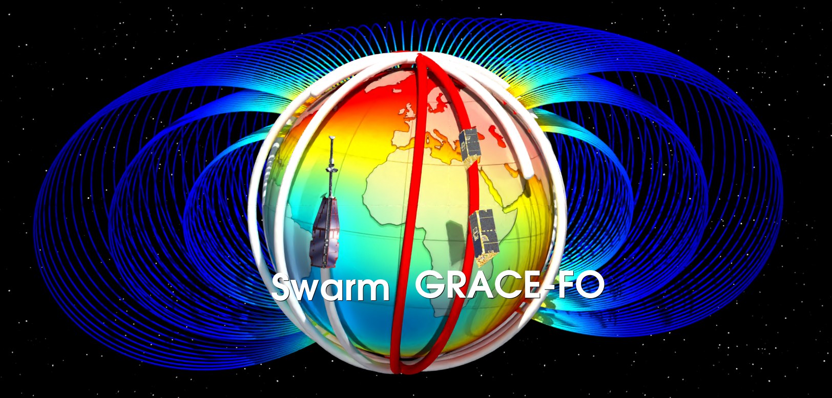
GRACE-FO carries Platform Magnetometers that can be used for science
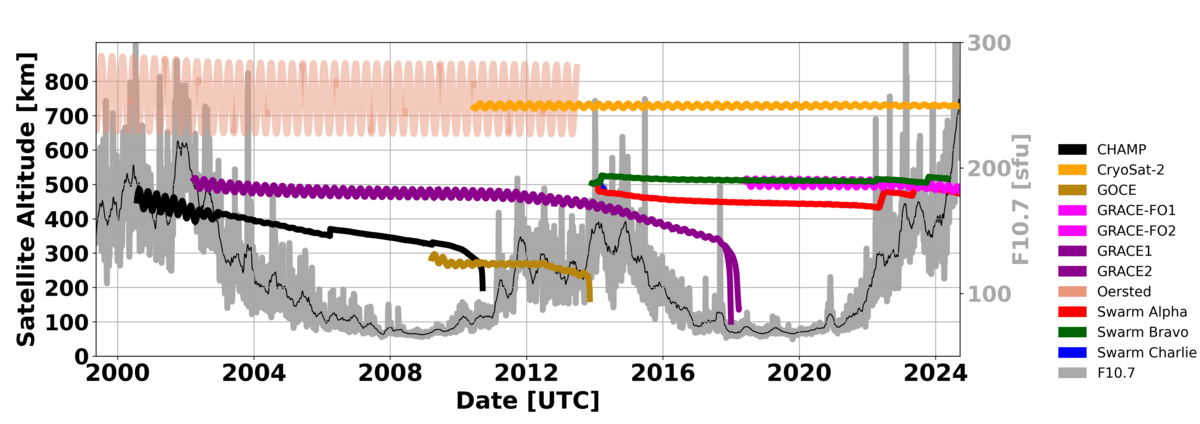
Scientific satellites for measuring the Earth's magnetic field such as CHAMP (2000 to 2010) and Swarm (since 2013) contain a number of special instruments (scalar magnetometers, vector magnetometers, star sensors, optical bench, boom). This system of instruments can be calibrated in itself. In addition, a lot of effort has been put into ground calibration and the magnetic cleanliness of the satellites. This includes calibrating the magnetometers and eliminating all known magnetic fields generated by the satellite itself (characterization) during the design phase. The data from these satellite missions are used to create high-resolution magnetic models for the core field, the Earth's crustal field and external magnetic fields. Examples of these models are Mag.Num (Rother et al., 2021), the International Geomagnetic Reference Field (IGRF) and CHAOS-7 (Finlay et al., 2020).
Ingo Michaelis, GFZ
Importance of magnetometers in data gaps
Satellite missions have a finite duration, they are limited by factors such as the available fuel, the aging of scientific instruments and unexpected failures. This can lead to gaps between two missions if follow-up missions are not planned and launched in time. In these time gaps, modeling the Earth's magnetic field is difficult due to a lack of data. In addition, the satellite cannot be in all places on Earth at the same time, which is disadvantageous, especially as there are gaps in the coverage of all local times for studies of rapidly varying external magnetic fields.
To fill these gaps, data from so-called platform magnetometers, which are present on many other satellites, can be used. Although the data from these on-board instruments do not have the highest accuracy of special magnetic field missions, they can be used for scientific applications through additional data processing. Many satellites such as GRACE-FO (Gravity Recovery And Climate Experiment) use vector magnetometers as part of their attitude control system (AOCS), i.e. for stabilizing the flight attitude and for navigation. Due to the lack of reference magnetometers, high-resolution magnetic field models are used as a reference for calibration and characterization in flight. The availability of these models therefore limits the possibility of calibration.
Once the calibration is done, missions like GRACE-FO can help to obtain information about the Earth's magnetic field and the electric currents in near-Earth space. These additional data sets are extremely valuable to fill temporal gaps between dedicated scientific magnetic field missions (e.g. CHAMP, Swarm) as well as spatial gaps in the global distribution, e.g. in satellite altitude and local time. The project website with published articles and data sets is located in the Information System and Data Center (ISDC) of the GFZ.

Who supports the calibration?
Besides support by GFZ, the Swarm Data, Innovation, and Science Cluster (Swarm DISC) is an international consortium to enhance the scientific return of the Swarm satellite mission. One of the tasks of the Swarm DISC includes developing, identifying, selecting and disseminating new Swarm products and services, as well as, including products from other Low Earth Orbit (LEO) missions whose data supports the Swarm mission objectives.
Here, the primary interest is data products that address phenomena in the magnetosphere-ionosphere-thermosphere system. The data products of GRACE-FO are published on ESA's payload data ground segment (PDGS) by GFZ Helmholtz Centre for Geosciences through the Swarm DISC support.
How reliable is the calibrated dataset?
Figure 2 shows maps of the Earth's crustal magnetic field in nano Tesla (nT). The left figure a) shows the Earth's crustal magnetic field calculated from the GRACE-FO platform magnetometer data with the data as measured by the satellite. The middle figure b) shows the Earth's crustal magnetic field from satellite data after calibration and characterization. The right figure c) shows the Earth's crustal magnetic field of a high-resolution scientific model (Thébault et al., 2021), i.e. the expected result. After calibration and removal of all magnetic fields generated by the satellite itself, structures of the Earth's crustal magnetic field are clearly visible, figures b) and c) are similar. In contrast, in figure a) no structure of the Earth's crustal field can be seen, because a disturbing signal with an amplitude about 20 times greater covers the actual signal. This could be removed by calibration and characterization.

Further research of magnetic field from satellites carrying platform magnetometers
There is an on-going challenge of finding useful satellite missions, getting in contact with satellite providers, retrieving the datasets and applying the calibration. When changing from classical analytical approaches to machine learning-based methods, we opened a wide field of applications to other satellite missions. Using our new Machine Learning method, we are able to use the full satellite telemetry for calibration and characterisation with a minimum of pre-selection. And we are fully prepared for the upcoming GRACE-C mission.
References and Links
- Platform Magnetometer Overview https://isdc.gfz-potsdam.de/platform-magnetometer/
- SWARM Data Access https://swarm-diss.eo.esa.int/#swarm/Multimission
- SWARM DISC (Swarm Data, Innovation, and Science Cluster) https://earth.esa.int/eogateway/activities/swarm-disc
- Finlay, C.C., Kloss, C., Olsen, N. et al. The CHAOS-7 geomagnetic field model and observed changes in the South Atlantic Anomaly. Earth Planets Space 72, 156 (2020). doi.org/10.1186/s40623-020-01252-9
- Michaelis, I., Styp-Rekowski, K. M., Rauberg, J., Rother, M., Kervalishvili, G., and Korte, M.: Calibration and Characterisation of GRACE-FO Magnetometers, GRACE/GRACE-FO Science Team Meeting, Potsdam, Germany, 8–10 Oct 2024, GSTM2024-13, https://doi.org/10.5194/gstm2024-13, 2024.
- Rother, M., Korte, M., Morschhauser, A. et al. The Mag.num core field model as a parent for IGRF-13, and the recent evolution of the South Atlantic Anomaly. Earth Planets Space 73, 50 (2021). doi.org/10.1186/s40623-020-01277-0
- Stolle, C., Michaelis, I., Xiong, C. et al. Observing Earth’s magnetic environment with the GRACE-FO mission. Earth Planets Space 73, 51 (2021). https://doi.org/10.1186/s40623-021-01364-w
- Styp-Rekowski, K., Michaelis, I., Korte, M., & Stolle, C. (2024). Physics-informed neural networks for the improvement of platform magnetometer measurements. In Physics of the Earth and Planetary Interiors (p. 107283). Elsevier BV. https://doi.org/10.1016/j.pepi.2024.107283
- Thébault, E., Hulot, G., Langlais, B., & Vigneron, P. (2021). A spherical harmonic model of Earth's lithospheric magnetic field up to degree 1050. Geophysical Research Letters, 48, e2021GL095147. https://doi.org/10.1029/2021GL095147
