Picture of the Month - July
Change of ice mass and motion of the bedrock
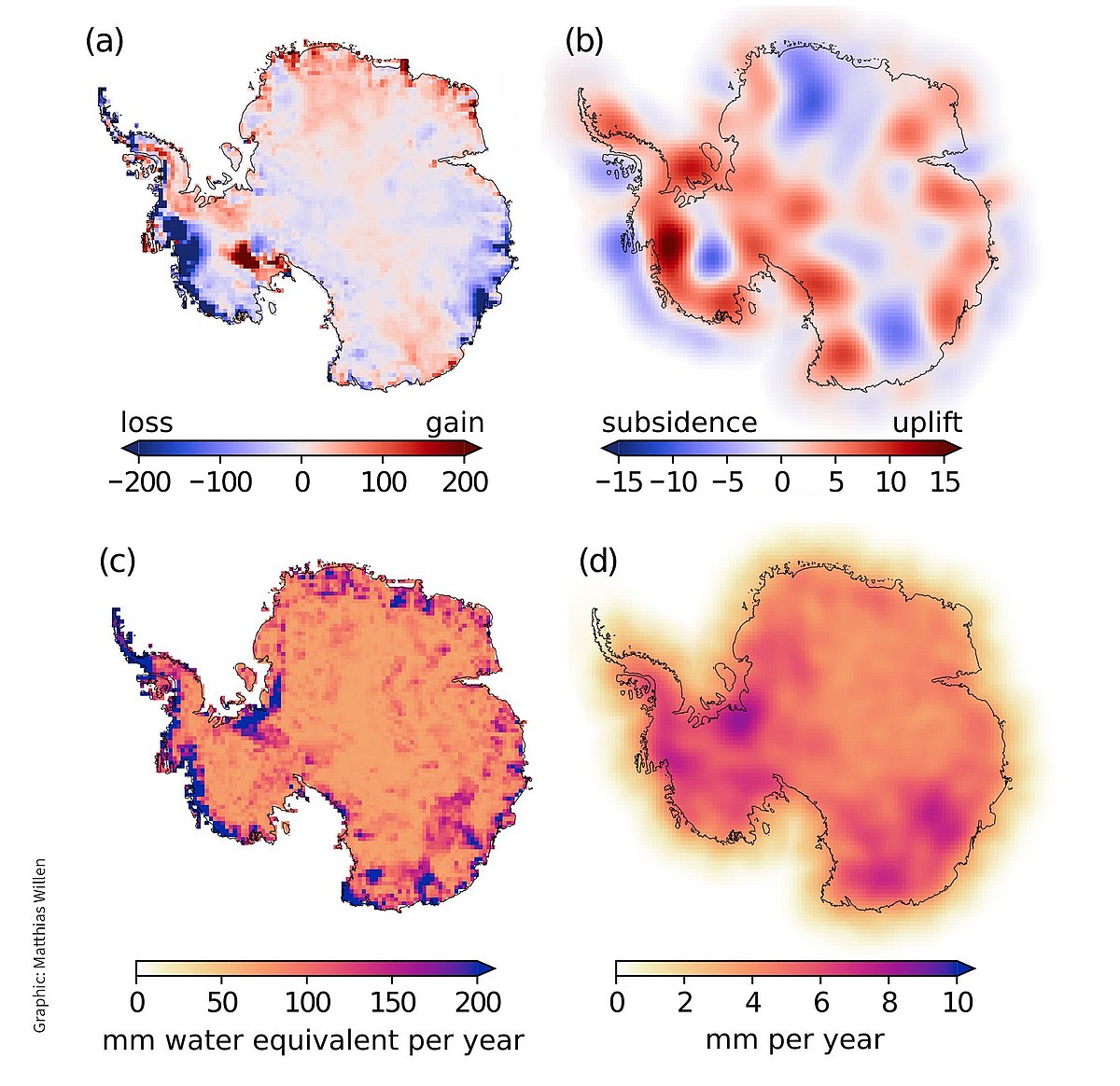
The four Antarctic maps show the results of a joint analysis of GRACE and GRACE-FO with data from the CryoSat-2 satellite from January 2011 until December 2020. CryoSat-2 carries an altimeter and continuously measures changes of the ice surface elevation. GRACE and GRACE-FO measure changes in ice mass, but cannot distinguish these from mass changes in the Earth's interior, which leads to major uncertainties. The mass changes in the Earth's interior are caused by glacial isostatic adjustment and also lead to motion of the bedrock.
By jointly analysing both satellite data, it is possible to determine the change in ice mass with high spatial resolution (a) and simultaneously calculate the motion of the bedrock (b). In addition, the uncertainty of the ice mass change (c) and the motion of the bedrock (d) can be calculated. The standard deviation times two is given.
The calculation shows that the Antarctic ice sheet lost an average of -144 ± 27 gigatons of ice mass per year from January 2011 to December 2020, i.e. over 10 years. In 10 years, this corresponds to a huge ice cube almost 12 kilometres wide, 12 kilometres long and 12 kilometres high. However, where these mass changes occur varies strongly. The greatest mass loss is taking place in West Antarctica. But, there are also areas where mass has been gained. Overall, the Antarctic ice sheet has lost mass and computer simulations show that this loss of ice mass will accelerate in future.
