Picture of the Month - November
Long-term changes in the East African Rift‘s hydrology
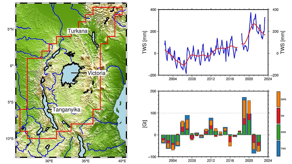
The graph shows the long-term changes in terrestrial water storage (TWS) in the northern part of the East African Rift Valley. In the 22 years of data, two extreme events occurred in the region: a drought until 2006, and heavy rainfall with floodings in 2020 (top left image).
The region is dominated by the large lakes Victoria, Tanganyika and Turkana, which store and retain rainfall. It is important to note that Lake Victoria is now a reservoir and its outflow and storage volume is influenced by humans.
TWS is the sum of all water reservoirs, i.e. groundwater, surface water and soil moisture. With independent satellite data, these water storages can be observed separately to better understand the long-term changes in TWS (bottom right). Here you can see that in the early years before 2006, lake storage accounted for a larger proportion of TWS changes than in the later years after 2019. Before 2006, Lake Victoria again contributes disproportionately to the storage changes in surface waters. We know from other studies that too much water was released from the Lake Victoria dam in these years. However, during the floods in 2020 and subsequent years, at the dam only a “natural” amount of water was released.
Overall, this region shows how both man-made decisions and extreme weather events influence TWS in the long term.
Text and Graphics: Eva Boergens, GFZ
Download
You may use the graphic by stating the copyright.
Download the graphic via the media library
Reading tips
- Focuspage on Terrestrial Water Storage
- Focuspage on Groundwater
- Blog: Observation of long-term changes in the East African Rift‘s hydrology with GRACE and GRACE-FO
