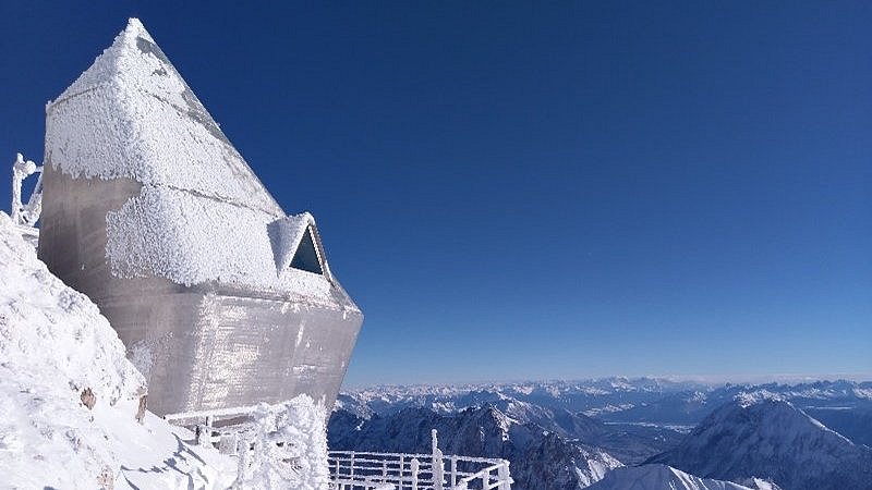
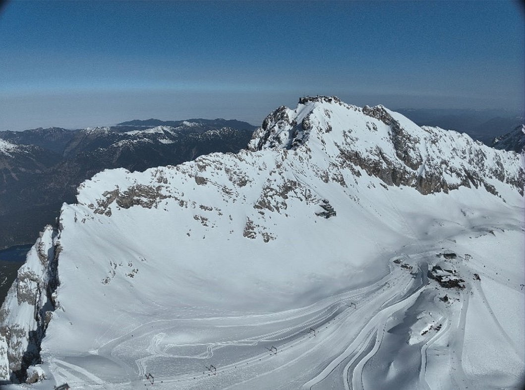
The international project G-MONARCH (Gravity-Monitoring for Alpine Research Catchment Hydrology) aims at a better understanding of high alpine hydrology. The Zugspitze, almost 3000 metres high, serves as a model region (Fig. 1). The area around Germany's highest mountain can be imagined as a funnel ("natural lysimeter"). Together with our project partners from Vienna and Augsburg, we at the GFZ Helmholtz Centre for Geosciences in Potsdam want to find out how the amount of water in the funnel changes, how much water enters the funnel (e.g. through rain, snow and glacier melt), how much water flows out of the funnel (at the so-called "Partnach spring") and how long the water takes to travel. The special feature of this project is that gravimetric methods are used in addition to classical hydrological methods.
Korbinian Achmüller, GFZ | Technische Universität Berlin
Gravimetry explained simply
![[Translate to English:] Luftaufnahme Rathaus München](/fileadmin/_processed_/e/0/csm_abb2_achmueller_9c92d64ab5.jpg)
A thought experiment: You go to Marienplatz in Munich in the morning (Fig. 2). There is not much going on. You drop a stone from the balcony of the town hall - what happens? The stone falls to the ground because it is attracted by the great mass of the earth. You do the same at noon: all the seats are taken. People are already "standing on each other's feet". You drop another stone (taking care not to hit any passers-by) - what happens? The stone falls faster because the crowd attracts it even more. The same thing happens at the top of the Zugspitze: in winter, when there is up to 5 metres of snow, the stone falls faster than in summer. If you have a very accurate stopwatch, you can use the different fall times to determine how the so-called gravitational acceleration of 9.8... m/s2 has changed. This is the acceleration that occurs during free fall. We measure it with a gravimeter. The change in gravitational acceleration tells us how much mass has been added and removed.
What is the superconducting gravimeter doing on top of Mount Zugspitze?
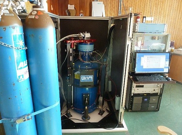
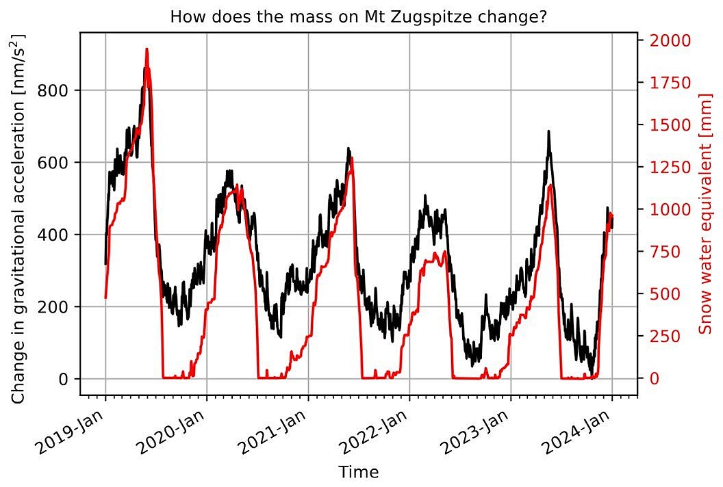
There is a so-called "superconducting gravimeter" on the summit of Mount Zugspitze (Fig. 3). We use it to measure the redistribution of mass in the Zugspitze area every second with maximum accuracy and stability. Let's assume that we place our superconducting gravimeter on the balcony of the Munich Town Hall. We measure in the morning. Marienplatz is still empty. Later, more and more people arrive. We assume that there are already 375 people (with an average weight of 75 kg) on Marienplatz. We measure again. The accuracy of the superconducting gravimeter is so good that we can detect the difference in mass caused by these 375 people (this corresponds to a precision of 1 nm/s2; 1 nanometre (nm) is 0.000000001 metres). If there is up to 5 metres of snow in the Zugspitze area in winter, the effect of this additional mass on the gravimeter is the same as if 190,000 people were standing on Marienplatz in Munich (a difference of about 500 nm/s2) - but they would have to stand very close together to make room for everyone.
How do gravimetric and classical hydrological methods complement each other?
If masses are added, removed or redistributed within a radius of up to 4 km around the gravimeter, we measure this as a change in gravitational acceleration (= acceleration in free fall, see above) - provided we have made corrections for mass variations due to tides and in the atmosphere, among others. However, we do not initially know what causes this change in mass - it could be snow, rain, glaciers, groundwater, permafrost or erosion. Hydrologists, glaciologists, geologists and geophysicists use classical hydrological methods to measure individual components of the Alpine system at specific points in the area, but not its entirety. This can only be done with gravimetric measurements. By combining gravimetric and hydrological methods, we gain valuable information about water storage (on very different time scales - from single precipitation events to long-term glacier melt due to climate change) and contribute to a better understanding of the "funnel" Zugspitze.
How does a gravimetric measurement campaign on the Zugspitze work? What do we need?
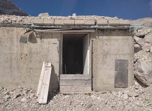
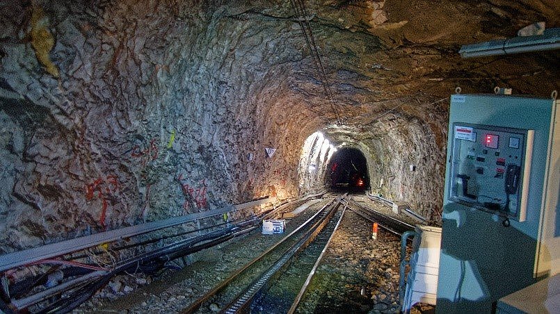
Since 2023, we have been taking field measurements at Zugspitze four times per year. The most important instruments are our gravimeters. In addition to the above-mentioned superconducting gravimeter on the summit of Zugspitze, another gravimeter is permanently installed in the tunnel of the Zugspitze cog railway (Fig. 4). For field measurements we use small portable gravimeters. With the gravimeter in our backpack, we walk to all the field points in the Zugspitze area over several days. The position and height of these points are precisely measured (Fig. 5). We take several measurements at each point (e.g. once in the morning and once in the afternoon) to minimise measurement uncertainties. This quickly adds up to several kilometres and metres of elevation. In winter, we can use ski lifts, but some of the field points have to be cleared of snow first, which is tedious shovelling work when the snow is several metres high. After this tiring field work, it is time to put on our headlamps and walk into the cog railway tunnel, where we can only take measurements outside of operating hours. After a week's measurement campaign in hopefully good weather, we return to the office to analyse the measurements - to see how the mass on Germany's highest mountain has changed since the last measurement campaign.
Further Information
Voigt, C. (2023) Forschung in luftiger Höhe: Der Wasserhaushalt in den Alpen. Supplement to Geographische Rundschau 3-2023 in cooperation with the GFZ. [in German]
Time series of the superconducting gravimeter on the summit of Mount Zugspitze (Fig. 6)
